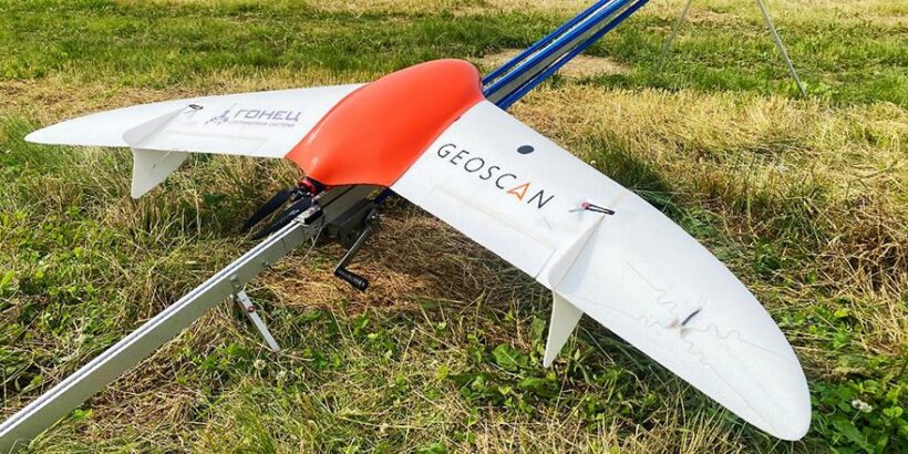
Within the framework of the Archipelago-2024 project-educational forum, a large-scale exhibition of unmanned aerial vehicles was held on the territory of the Pushisty aerodrome (Sakhalin Island). Gonets Satellite System and Geoscan presented Geoscan 201 unmanned aeroplane equipped with Gonets experimental on-board modem and a special antenna of light form-factor for the possibility of controlling the drone from the satellite. This was reported in the press-service of Geoscan Group of Companies.
Within the framework of the experiment, from 13 to 16 July 2024, during ground tests and flights at the Pushisty aerodrome, for the first time in Russia, the possibility of communication installation was assessed, telemetry data was transmitted from the Geoscan 201 UAV to the Gonets-M satellite, as well as commands were sent from the Geoscan ground control station to the UAV via satellite. A total of six flights were performed, during which the FTP-server in the Data Processing Centre of the Gonets satellite system received 218 information messages with the drone telemetry, and three information messages with commands for in-flight control via feedback were also transmitted. In addition, Geoscan 201 successfully transmitted data on its location and telemetry, and a command was sent to the UAV to force the drone to return to the launch point.
Pavel Cherenkov, Director General of Gonets Satellite System JSC, noted that Russian satellite communication systems with ubiquitous coverage expand the horizons of technological development of unmanned aircraft systems. Such control systems for unmanned aircraft complexes with control of their location and status allow to significantly reduce the risks of aircraft loss. Cherenkov emphasised that the conducted flights demonstrate the development of unmanned solutions, where satellite technologies enable over-the-horizon control of all types of UAVs and obtain necessary information from the flight zones.
Satellite systems are of great importance for aircraft location control on the scale of Russia, most of the territory of which is not covered by other types of communication. The development of space technologies will make it possible to increase the area of survey during rescue and firefighting operations, as well as to adjust the flight parameters of UAVs in the event of abnormal situations. Due to their multifunctionality, satellite systems are more promising and cost-effective in terms of investment compared to ground infrastructure.
The conducted experiment demonstrated the possibility of effective use of satellite technologies for control and monitoring of unmanned aerial vehicles. The results obtained open up prospects for the application of unmanned solutions in various industries, including defence, agriculture, environmental monitoring and other spheres.
 (No Ratings Yet)